River, Lake or Canal: Reading Three Kinds of Waterway
River, lake or canal map reading helps you compare water shapes and connections, judge what a map can establish, and choose when to check another source.
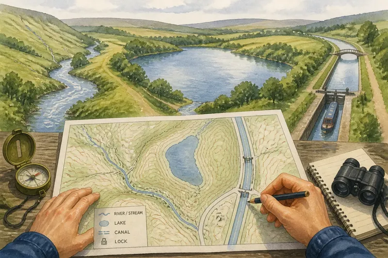
How can you tell a river from a lake or canal on a map without a label? River, lake or canal map reading starts with the shape and connections, but those clues cannot always establish what a feature is. Trace the blue mark, compare it with the land around it, then separate a plausible reading from a confirmed one.
Start with symbols, then test the shape
Check the map key before interpreting a blue line or patch. Depending on the map, blue lines may show rivers, streams, drains or canals; blue areas may include lakes, ponds, reservoirs or wetlands. Line styles, names and symbols can narrow the possibilities. If the key is silent, the outline alone may not reveal whether a water body is natural or man-made.
Then follow the feature beyond the spot you first noticed. Look for branching lines, an enclosed shoreline, a channel continuing through the landscape, or signs of managed navigation such as locks. Contours, shaded relief, roads and settlements add context, but they do not turn an ambiguous shape into certainty.
Keep the map’s scale in mind. A regional map may simplify a winding river or omit a small stream; a detailed map may show features that disappear when you zoom out. If a line vanishes at a road or railway crossing, follow it on the other side before deciding it ends there.
Recognise a river by its connected channel
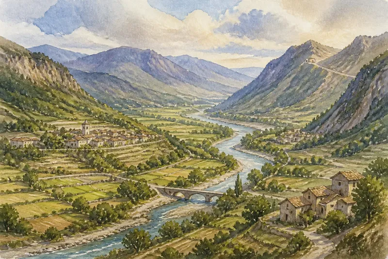
A river is usually mapped as a line or narrow band that continues through the landscape. Smaller streams may join it, and it may bend through a valley before reaching a lake, another river or the sea. A network of branches converging from higher ground is a useful clue to a drainage system.
Contours can help place the channel in its surroundings. Where contour lines form V shapes across a valley, their points commonly indicate the uphill direction. This can support an interpretation of the river’s route, but many maps do not show flow explicitly, and a river may be controlled or altered by people.
Do not infer current conditions from a map. It may not show seasonal changes, dry stretches or managed water levels. If your plans depend on conditions at the water, check current local information and follow signs on the ground.
Identify a lake by its enclosed water area
A lake appears as an area of water enclosed by land, with a shoreline rather than a channel running continuously across the map. Rivers or streams may enter or leave it; those connections do not make the lake itself a river. Follow the shoreline and the channels separately to see where each feature begins and ends.
An irregular outline can suggest a natural basin, but it is not proof. Reservoirs, ponds, quarry lakes and wetlands can also appear as enclosed blue areas. A label or map key may identify a reservoir; where neither does, the shape alone cannot settle the feature’s origin.
Nearby terrain and structures can provide context. A dam symbol or a channel leading away from a managed water body may support a reservoir interpretation, while relief may show that water sits in a basin. Treat these as clues, not confirmation, unless the map identifies the feature.
Distinguish a canal from a straightened river
Canals often have straighter reaches, sharp turns or a regular-looking channel that crosses the natural contours. Locks, towpaths, bridges and wharves can indicate managed navigation. A canal may connect rivers or other waterways along a route that does not follow a natural drainage channel.
A straight line alone is not enough. Rivers can be engineered, and drainage channels can also have regular banks. Look for several clues together, such as a canal name, lock symbols and a route that appears to cross between waterways. If the map offers no decisive symbol or label, leave the identification open rather than treating geometry as proof.
There is little value in measuring every bend or trying to infer current speed from a general map. For basic identification, tracing the channel and checking the key is more useful.
Apply the clues without claiming more than the map shows
Say you are planning a walk and find an unnamed blue feature: a thin branching line, an enclosed patch of water and a straight channel beside a lock symbol. You check the key and find that it distinguishes streams and canals but not reservoirs. You trace the branching line into a valley and see it continue towards the enclosed patch; that supports reading it as a river feeding a lake, without proving the patch is a natural lake. The lock symbol and straight route support identifying the third feature as a canal. For a route choice, you follow the marked path only as far as the map shows it, then check local signs for access and conditions.
- If the key labels the line as a river, treat that as the map’s identification; if the key is absent or unclear, trace its branches and describe it as a likely river only when the channel pattern supports that reading.
- If several smaller channels join one continuing line, read the pattern as a likely river system; if they do not, inspect a wider map area before deciding whether the mark is a stream, drain or another feature.
- If blue water forms an enclosed area, check its label and key for a lake or reservoir; if neither identifies it, call it an enclosed water body rather than claiming a natural origin.
- If a lock symbol appears beside a straight channel, check the key and nearby names for a canal; if those clues are missing, consider an engineered river or drain as alternatives.
- If contours show a valley around a channel, use that relief as support for a river reading; if the contours are missing or unclear, rely on the channel’s mapped connections and keep the conclusion cautious.
- If a water feature seems to stop at a road or railway, trace it beyond the crossing; if the line remains absent, check a more detailed map before treating it as an endpoint.
- If a path follows part of a shoreline, use only the mapped section when planning; if access is unclear or conditions matter, check signs or current local information before going further.
What can a map establish about a water feature?
Can a river flow through a lake?
Yes. A river may enter a lake and another channel may leave it, so the connected water system contains distinct river and lake features. Follow the shoreline and channels separately on the map.
How can I tell a canal from a straightened river?
Look for combined clues such as a canal name, lock symbols, towpaths and a route connecting waterways. A straight course by itself cannot distinguish a canal from an engineered river.
Does an enclosed blue shape prove the water is a natural lake?
No. It may be a reservoir, pond, quarry lake or wetland. Check labels and the map key; if they do not resolve the origin, keep the description general.
Can a map show which way water is flowing?
Contours and the channel’s position in a valley may suggest downhill direction, but many maps do not mark flow. For practical decisions that depend on current conditions, consult local information rather than relying on an uncertain inference.
River, lake or canal map reading is most reliable when it distinguishes what the map identifies from what its shapes merely suggest. A label or symbol can settle a classification; without one, describe the visible evidence and keep uncertain origins open. That careful wording is useful when you check the feature on the ground or explain your route to someone else.